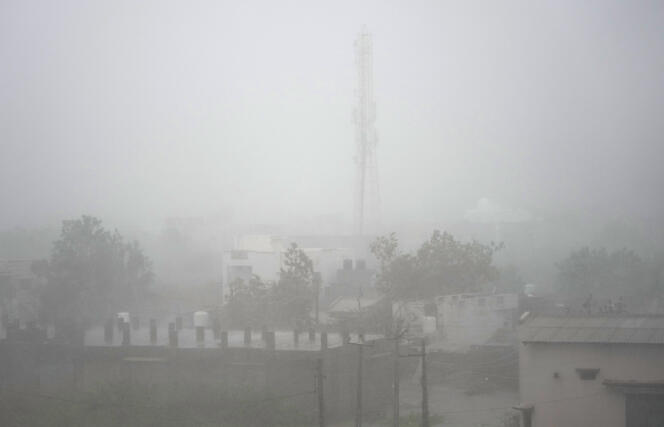
Cyclone Biparjoy weakened on Friday morning June 16 as it moved north, after hitting the Indian coast, bringing strong winds and impressive waves against the Indian and Pakistani coasts, but no casualties. More than 180,000 residents of the western Indian state of Gujarat and neighboring Pakistan have already been relocated from areas Biparjoy is expected to pass through.
Less powerful than expected, the “a very strong cyclone” crossed the coast near the port of Jakhau (West) on Thursday night and was blowing strong winds up to 125 km/h, before starting to die out a few hours later. India’s forecasters expect him to settle down and be moderately depressed by Friday evening.
Hundreds of power poles fell along the coast, causing power outages in large parts of the area, a spokesperson for the Gujarat government told Agence France-Presse. Several hundred trees were also downed and emergency teams struggled to access the village because of the debris on the road. No casualties were reported overnight, the office of the state aid commissioner said. More than 100,000 residents of the state have left coastal areas for shelter inland, according to authorities.
In Pakistan, Climate Change Minister Sherry Rehman announced that 82,000 people had been evacuated from the southeastern coastal region.
300mm of rainfall is expected in Pakistan
Friday morning, M.I Rehman announced in twitter that his country has “largely untouched by the storm at the peak of its power”. More than 300mm of rain, however, is expected in some coastal areas of Pakistan on Friday and Saturday, accompanied by storm surge of up to 2.50 metres. Shops were closed late on Thursday in the Pakistani city of Badin, and the normally bustling streets were empty as night fell.
“Everyone was so scared”, Iqbal Mallah, a 30-year-old civil servant, told Agence France-Presse (AFP) on Friday. Typhoons are common in this Indian Ocean region, home to tens of millions of people. But scientists explain that this phenomenon is gaining strength due to global warming.
One of them, a climatologist at the Tropical Meteorological Institute of India Roxy Mathew Koll, told AFP that the cyclone draws its energy from warm waters and that surface temperatures in the Arabian Sea, also known as the Arabian Sea, are 1.2 to 1.4 degrees Celsius higher than four decades ago.
“Rapid Arabian Sea warming, coupled with global warming, is likely to increase the flux of heat from the ocean to the atmosphere and drive more intense cyclones”he summed up.


